
This post has been read 1594 times!
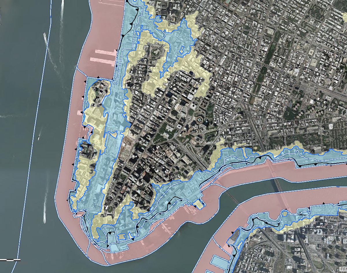 November 10, 2016- Downtown Express reports, “The federal government has finally agreed to take another pass at the revised flood-risk maps it drew up after Hurricane Sandy which would have slammed thousands of homes and properties with sky-high rate hikes for flood insurance
When the Federal Emergency Management Agency unveiled preliminary versions the city’s new Flood Insurance Rate Map, or FIRM, Mayor DeBlasio asked the agency for a do-over on the map because it added 70,000 city properties into the “highest risk” areas — double the number as in the pervious FIRM from 2007.
The city forked over a 188-page report and a terabyte and a half of their own flood-risk data to convince FEMA they got it wrong, and after a year, the agency finally agreed.”
Of note, all of the BPC apartment buildings are NOT in flood zones, which was proven when Hurricane Sandy waters missed us (barely).