This post has been read 1550 times!
September 11, 2017- Once again, BPTV was the only news source of any size, blog or national, to accurately predict a hurricane that the others were hyping.
TV never shows the actual NASA/NOAA satellite images, and instead they show their own fictitious animations to scare you for TV ratings.
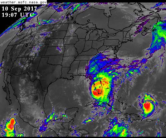 September 10, 2017 (2:00 PM)- Irma has made landfall at the Everglades and is breaking up. It was downgraded already to a category 3. It is more likely that it will become a tropical storm before it hits northern cities, such as Tampa, than it is to hit them as a hurricane.
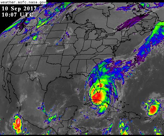 September 10, 2017 (6:00 AM)- The eye of Irma has barely moved overnight, stuck between the land masses of Cuba and the US. The farthest north rain bands have weakened.
The storm could do many things from here, including dissipate, but TV is insisting that it will barrel northward as a category 4 and destroy all of Florida. If the storm does head to Florida, the land will zap its energy before it gets above the Everglades.
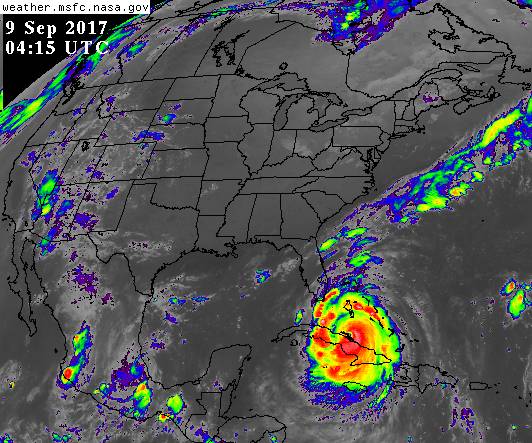
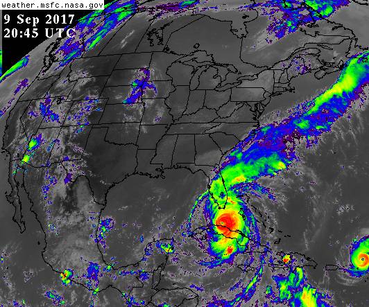 September 9, 2017 6:00 PM- The high pressure over the mainland is stalling Irma. It has reformed somewhat and looks to be more likely to go past Florida than make a 90-degree right turn.
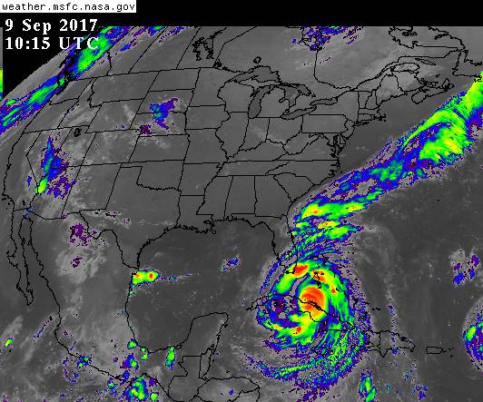 September 9, 2017- Hurricane Irma made landfall over Cuba and has begun to breakup, as predicted below. The high pressure forces over the mainland have increased and seem to be pushing Irma back east into the Atlantic rather than heading west to the Gulf Coast.
Regardless, the TV-hyped predicted path of Irma barreling straight up the Florida peninsula seems to be the least likely model right now.
To best follow storms of any kind, you can view the animated satellite images for yourself on NASA’s website.
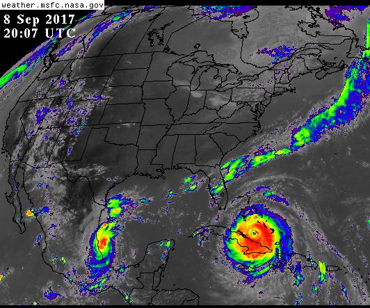
 September 8, 2017- by Steven Greer
Once again, the professional liars on TV are using fake cartoon animations to supposedly show how models are predicting that Hurricane Irma will somehow make a 90-dgeree turn and hit Florida. In fact, the actual satellite images indicate that a high pressure front on the mainland is pushing Irma south, and that it will pass over the southern tip of Florida and hit the Gulf Coast the hardest. Also, Cuba will weaken the storm even more.