
This post has been read 4170 times!
Update January 24, 2016- Because of the four days of bluster, hyperbole, lies, and exaggerations by the media for what was nothing but a normal snowfall with light winds, BatteryPark.TV is naming the snowstorm of 2016 “Trump”.
Update January 23, 2016 (22:50 PM)- The precipitation has ended and visibility is growing. The satellite shows that the tail of the storm is also gone.
The temperature is now close to melting, and the sidewalks and streets are already clearing.
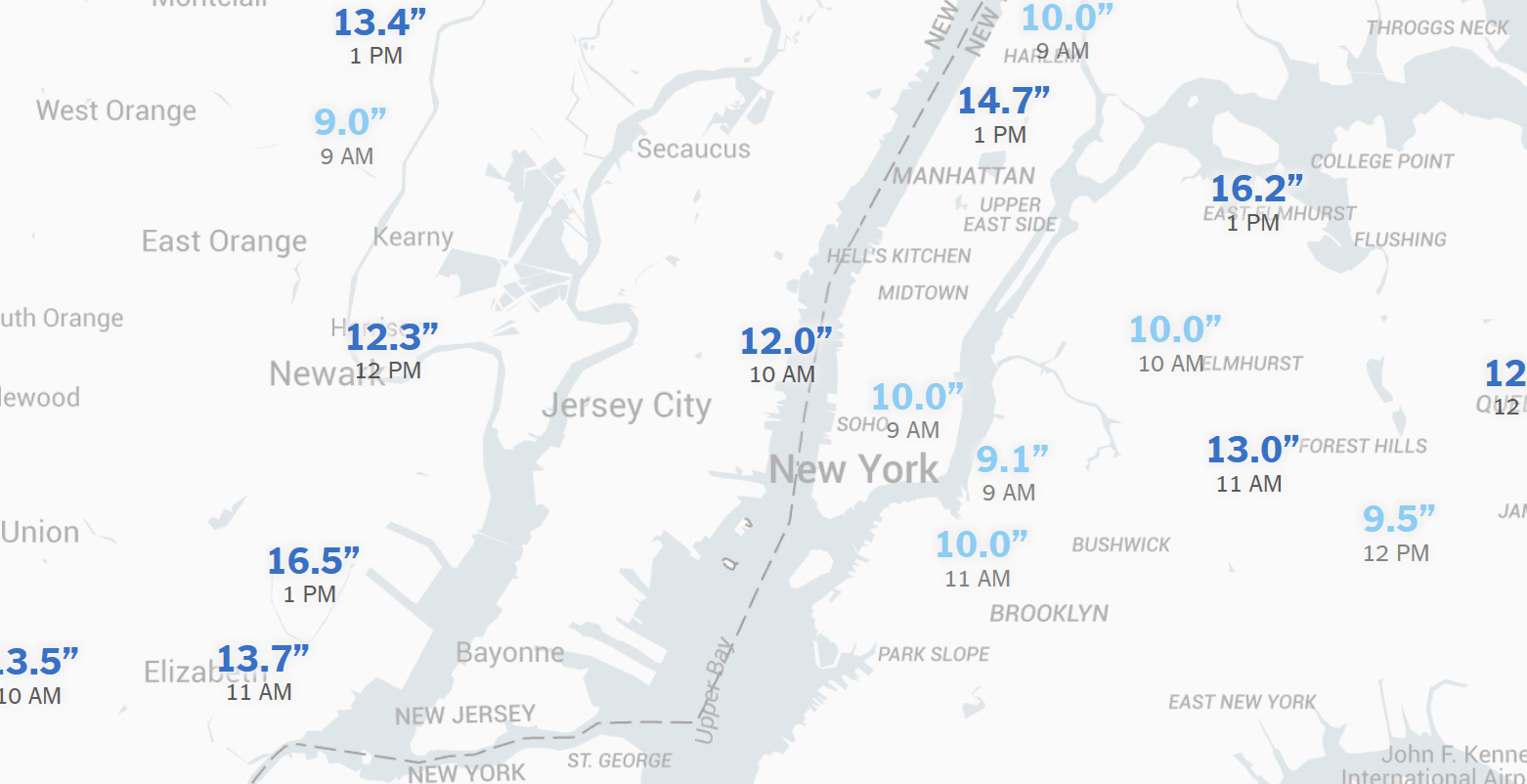
The snowfall came close to all-time records in Central Park. We got approximately 16-inches in Lower Manhattan.
It appears that the long snowstorm is over. Stay tuned.
However, it was never a blizzard though (see why, below). It was a long stalled snowstorm with low winds. The low visibility was caused by the fine dry snow.
This is not just semantics. The Nor’easter that the TV hypsters thought would happen never materialized as the front over the ocean fizzled out. That would have been a truly deadly storm with long power outages, etc. All we got was 24-hours of fun snow that will melt by the morning.
BatteryPark.TV was right. We inform.
Update January 23, 2016 (2:20 PM)- The cloud front is lingering but heading north. There are now approximately 10-inches of snow in Lower Manhattan with moderate wind. The blowing snow makes the storm seem worse than it is.
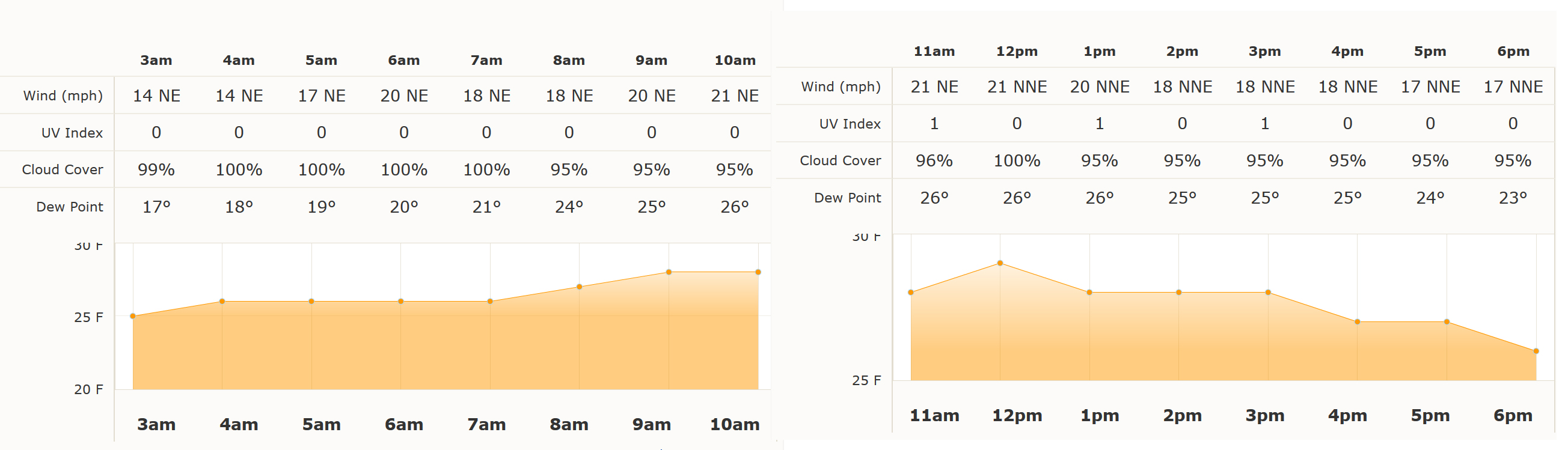
The winds have been tame, around 14-MPH (see AccuWeather graph below). Therefore, this is not a blizzard (A blizzard is defined as winds over 35-MPH for at least three hours).
New York is receiving a normal winter storm that will not set any records. We had more than 12 storms like this last year (Washington, DC received 14-inches). Yet, it is still being hyped as an “epic blizzard that shut down the East Coast”.
What caused the TV news to hype this as an epic blizzard many days ago was when they saw an ocean front heading west colliding with this storm over us now. That would have created a Nor’easter, but the ocean front blew out to sea. Therefore, we were hit only with a normal storm front that started in the Southern U.S. Only by a fluke has it lingered over land long enough to generate serious snow.
The NASA satellite images are seen here. It is best to watch the 30-picture animation to see the movement. Some more precipitation from New Jersey is on the way, so we will get a few inches in the city.
Update January 23, 2016 (6:30 AM)- The Eastward movement of the clouds stalled, allowing for some light snowfall. There is currently 4-inches on the ground in Lower Manhattan, which is far from the “epic blizzard” hyped.
Update January 22, 2016 (5:40 PM)- The clouds are now out to sea, and there was literally not even a single snowfall that hit New York. Told you so. We inform.
Update January 22, 2016 (2:44 PM)- The heaviest of the green precipitation is over us now and it is not generating any snow. We might not even get snow, much less the epic blizzard they scared us about.
Update January 22, 2016- The most “intense” part of the winter storm is now over Ohio. I called the police in Central Ohio. There is no snow precipitation there at all right now. This will not be a blizzard when it hits us later today.
Update January 21, 2016- The storm in the West is staying South and the Eastern ocean storm that was supposed to make the nor’easter is out to sea. We might get some snow, but it will not be a blizzard.
January 20, 2016- The lame TV news is showing their cartoon graphics of weather maps again, trying to hype the impending blizzard. However, they never show the real satellite images because it tells a less scary story.
Look for yourself here. There is no large storm on the way. be sure to animate the images.